Our Data Products
Quality is paramount at EG
We at Energy Graphics take pride in our reputation for data that is unmatched in the industry for its completeness and accuracy. We offer our INTELLEX® Data and EG Premium Data to industry customers who wish to purchase them for use in third party software applications. Customers may license an entire database or only data for a specific area. All data purchases may be made by clicking an order button and completing the order form, or feel free to contact us by Email or telephone.
EG INTELLEX® Data
These databases make up the INTELLEX® Data Suite, which is included with licenses of our INTELLEX® software products. With the exception of Logs, data from these databases may be purchased by the block or area.
Each database is:
- Custom Managed by our highly experienced data managers
- Updated Weekly to assure customers of current data
- Verified to maintain accuracy
EG PREMIUM DIRECTIONAL SURVEYS
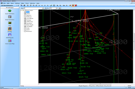 The Energy Graphics Directional Survey database is not just another copy of the Public Data you'll find offered by other data vendors. Energy Graphics, Inc. is the source for the Energy Information, Inc. proprietary Gulf of Mexico Directional Survey Database. This database has been painstakingly compiled over 20-plus years of cross-checking and verification to produce the most accurate and complete data possible for our clients and for use in our own custom services. It's the only database you'll need for your project development.
Directional Survey data may be ordered online using our INTELLEX® WEB online ordering system.
Features:
- Over 50,000 GOM wells
- Continuously Updated
- Includes Raw Data
- True North and/or Grid North Info
- Priced on a descending price per well basis
For more info: INTELLEX® WEB | View Brochure
To Place an Order: ![]()
EG SCOUT DATA GROUP
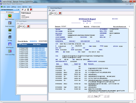 Through an agreement with the Offshore Oil Scouts Association (OOSA) Energy Graphics, Inc. can provide detailed drilling and well history/completion information through INTELLEX® Report. Users must be properly licensed by OOSA to receive this data and must also be members of the Energy Graphics Oil Scout Group.
Casing and Completions - Members of the Energy Graphics Scout Group, have an added database at their disposal with the Casing and Completions Database. Energy Graphics has taken data from the existing Scout well database and created the ability to view the casing and completions information in a List Report format instead of merely as a text comment. We're sure you will find many ways to use this data to your advantage now that we've made it easier to access.
Scout Data Reporting with INTELLEX® Report - The Scout Ticket report format in INTELLEX® Report was designed to emulate the format most oil scouts are accustomed to using. In addition to the Scout Ticket, EG Scout Group members can access their data to create a multitude of formatted and custom reports.
Features:
- Scout Tickets
- Drilling Reports
- Custom List Reports With tabs to associated INTELLEX® GOM data
- Weekly Summary Reports
- Weekly Scout Editor Reports
- Weekly Scout Check ReportsWeekly Detail Reports
Read how to join here: EG Scouts Data Group | View Brochure
EG PREMIUM WELL DATA - TEXAS STATE WATERS
 Texas State Waters well data database is updated constantly for utmost accuracy.
- API Number
- Areacode
- Block Number
- OCS Number
- Well Number
- Well Type
- Field
- Operator
- Spud and Completion Dates
- MD and TVD
- Surface and Bottom Hole Locations
![]()
ALASKA DATA
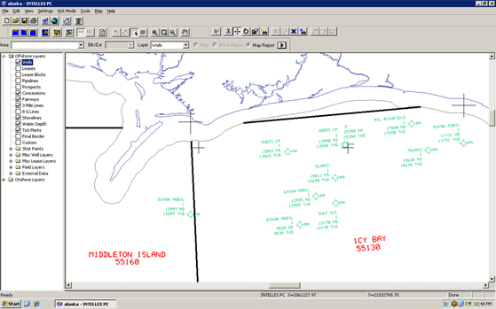 Alaska Lease Info and History - Alaska lease data includes current operator, current lease ownership and percentages, status, effective date, status date, 1st. production date, expected expiration date, initial lease period, rent per acre, lease suspension and extension data, termination date, Alaska region flag, low and high water depths, and distance to shoreline, plus all sale information, including sale number and date, areacode, block number, acreage, bonus, and bid per acre. This database is updated continuously for utmost accuracy using a variety of public information. Each lease has an accurate boundary description, whether it is a whole block or any portion thereof.
Alaska Wells - Alaska well data includes API number, areacode, block number, OCS number, well number, well type, field, operator, spud and completion dates, MD and TVD, surface and bottom hole locations. This database is updated constantly for utmost accuracy using BSEE sundry notices and completion reports. BSEE borehole information is used for quality control purposes and obtaining missing information.
![]()
APPLICATIONS TO DRILL
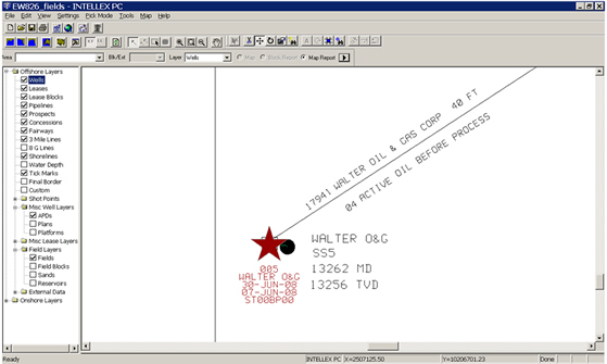 This is a database that contains information on Applications for Permit to Drill, or APDs, including the Area and Block, Lease Number, API Number, Company Name, Well Number, Water Depth, and APD Received Date.
- Area and Block
- Lease Number
- API Numbe
- Company Name
- Well Number</name>
- Water Depth
- APD Received Date
![]()
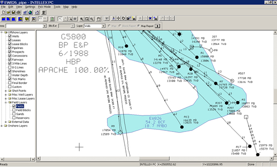
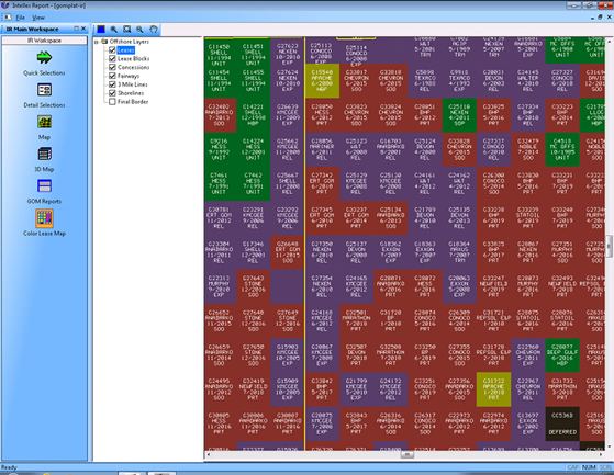
FIELDS & RESERVOIRS
 Fields & Reservoirs
FieldBase™ Field and Reservoir Data for the Gulf of Mexico. With FieldBase, users can retrieve and view information about fields and their producing units based on over 140 data elements.
- Over 1200 fields
- 8600 productive sands
- 25,000 fault-block reservoirs
- Regional Play Trends and Field Pools
- Over 140 Data Elements
- Updated Monthly
![]()
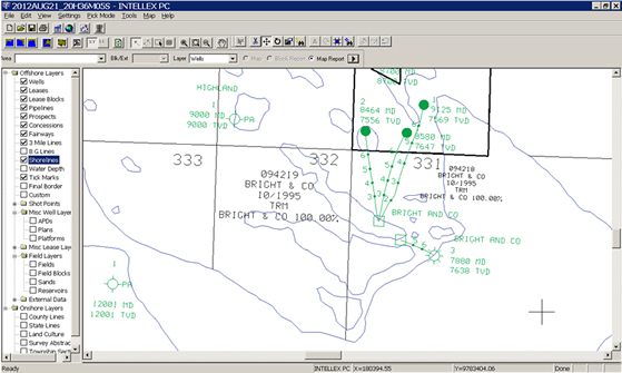
CULTURE
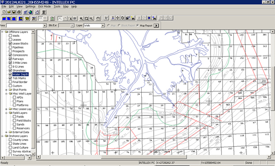 Culture Onshore - U.S. data includes state and county or parish boundaries and Alaska township/range/sections. Offshore - U.S. data includes Gulf of Mexico and Alaska.
- 8-g line, fairways
- field outlines
- lease blocks
- 5/8/10 year lease boundaries
- military warning areas
- royalty relief boundary
- shoreline
- 3-mile line
- water depths
![]()
LEASES
Lease associated databases include the Federal Waters Leases, current active and inactive Louisiana State Leases, current Texas State Waters Leases, and current and historical leases and bid histories for U. S. Gulf of Mexico Leases. Federal leases also include Plans and Prospects databases
![]()
GOM Federal Lease Data Features:
- Bid Histories (GOM Federal only)
- Lease Histories (Federal and State Offshore)
- Current Operator
- Current Lease Ownership & Percentages
- Status
- Effective Date
- Status Date
- Lease Production
- 1st Production Date
- Expected Expiration Date
- Initial Lease Period
- Rent Per Acre
- Lease Suspension & Extension Data
- Termination Date
- Gulf of Mexico Region Flag
- Low & High Water Depths
- Distance from Shore
- BSEE Serial Registry Remarks
- Operating Rights and Designated Operator
- Statistics
- Plans
- Prospects
Texas State Waters Lease Data Features:
- Texas Offshore Lease Blocks inside the 3-Mile Line
- Includes Bays
- Current Operator
- Status
- Effective Date
- Expected Expiration Date
- Initial Lease Period
- Rent Per Acre
- Lease Suspension and Extension Data
- Termination Date
- GOM Region Flag
- Sale Information
- Continuously Updated
LOG IMAGES
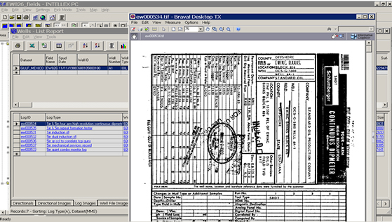 Energy Graphics has acquired the complete BSEE Log Images database for the Gulf of Mexico. Logs are available free to INTELLEX® software clients through The INTELLEX® Exploration System.
Note: Logs are currently not available for separate purchase.
PIPELINES
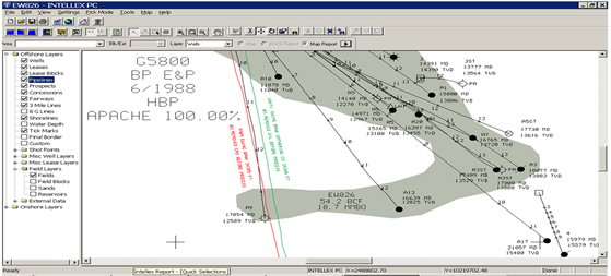 This unique proprietary database has been meticulously compiled from the "as-built" information recorded with the BSEE for each individual pipeline segment. Data is continuously updated using all location coordinates from as-builts and proposals available from BSEE.
Features:
- Compiled from "as-built" information
- Owner
- Pipe Size
- Pipeline length
- "comes from" and "goes to" data
- Status
- Product Service
- Continuously Updated
![]()
WELLS
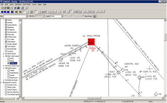 Gulf of Mexico Well related databases include Well Locations (Federal Waters), Plans, and Platforms. All well data is updated constantly for utmost accuracy using eWell Submissions and other government website applications. Public borehole information is also used for quality control purposes and obtaining missing information.
Features:
- Complex ID Number
- Drilling Flag
- Company Name
- Lease Number
- Production Flag
- Oil Production flag
- Abandon Flag
- Water Depth
- Distance To Shore
- Removed
- BSEE Area Code & Block
See Also: EG Premium Well Data - Texas State Waters above.
![]()